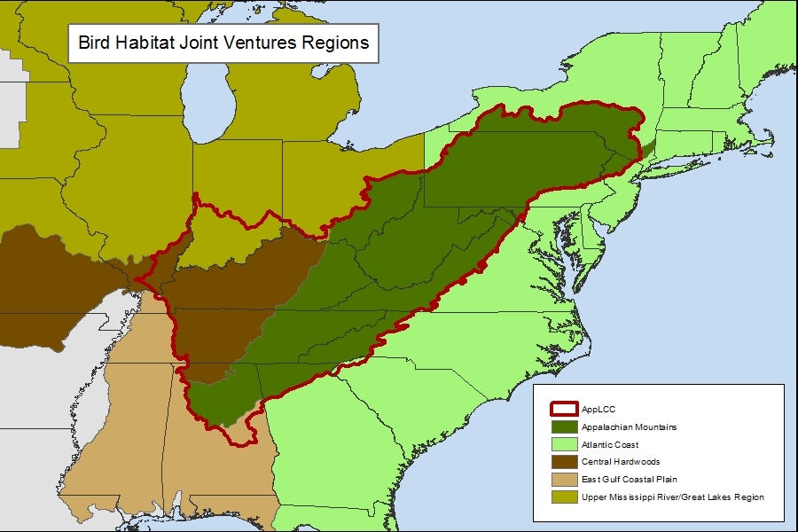
Map of Bird Joint Ventures within AppLCC Boundary
The Central Hardwoods JV and Appalachian Mountain JV both cover portions of the AppLCC boundary.
Publication Date: 2012
DOWNLOAD FILE — JPEG image, 243 kB (249,093 bytes)


