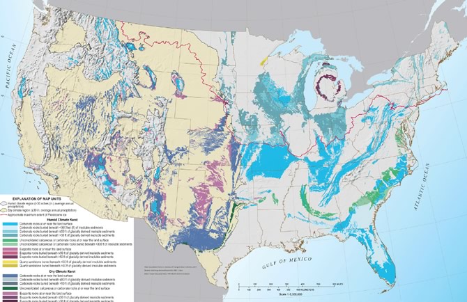
USGS Releases a New U.S. Karst Map
For the past several years the US Geological Survey has worked on developing a new karst map of the USA. Today they have released the digital map compilation and database at: http://dx.doi.org/10.3133/ofr20141156
Unlike the previous version from 1984, you can download this report and its maps digitally, but you can also download the map for display in GIS and Google Earth software. Additionally, the metadata (information sources) are digitally available. The authors, Dave Weary and Dan Doctor, plan to accept comments on this work, acquire other data, and then supersede it within a few years with a more formal series of maps, including printed paper maps. To send comments and for more information, visit the website above.


