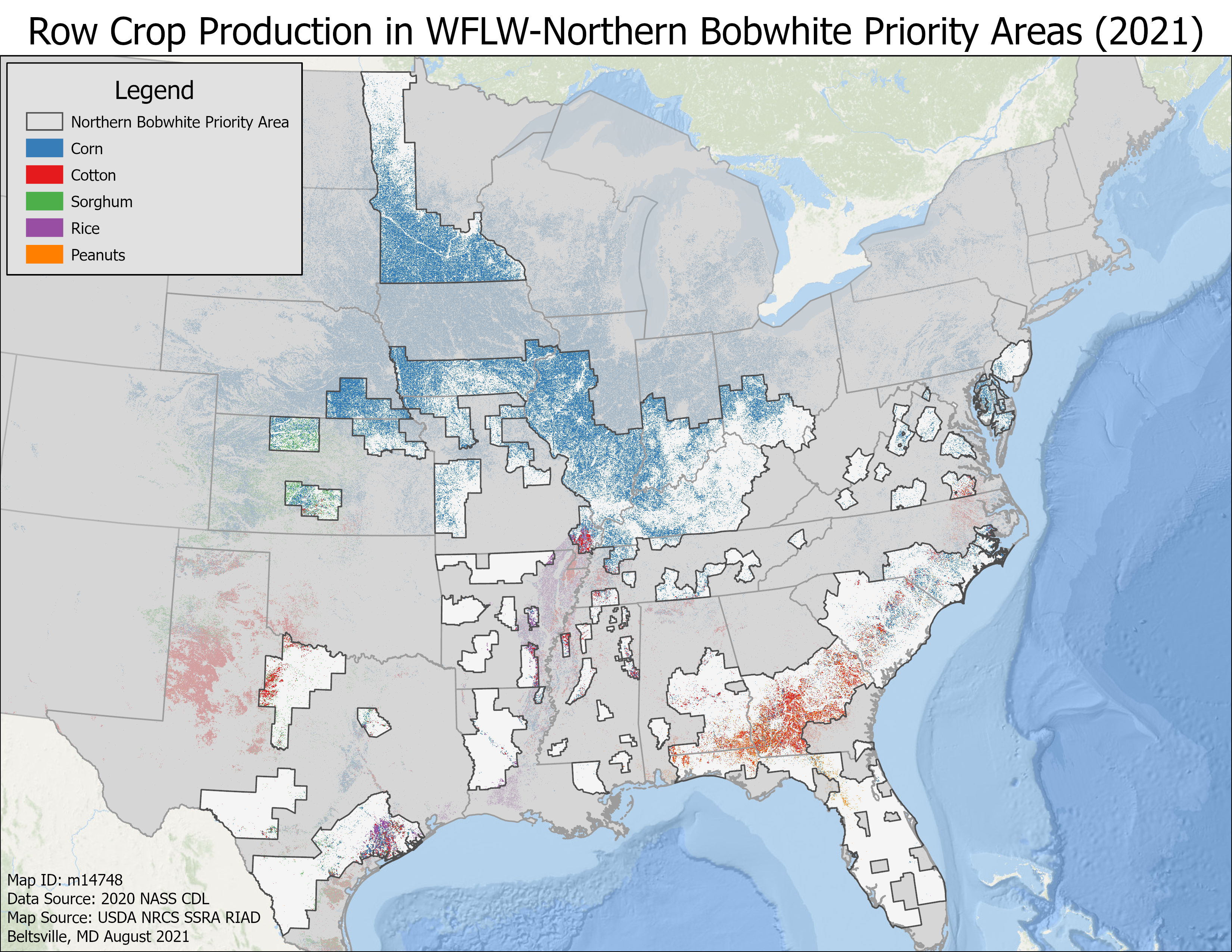
Map of Row Crops Produced in NOBO Range
Row crop production within WLFW Northern bobwhite, Grasslands, and Savannas framework boundaries.
Publication Date: 2021
Source: USDA data
DOWNLOAD FILE — PNG image, 3,485 kB (3,569,353 bytes)


