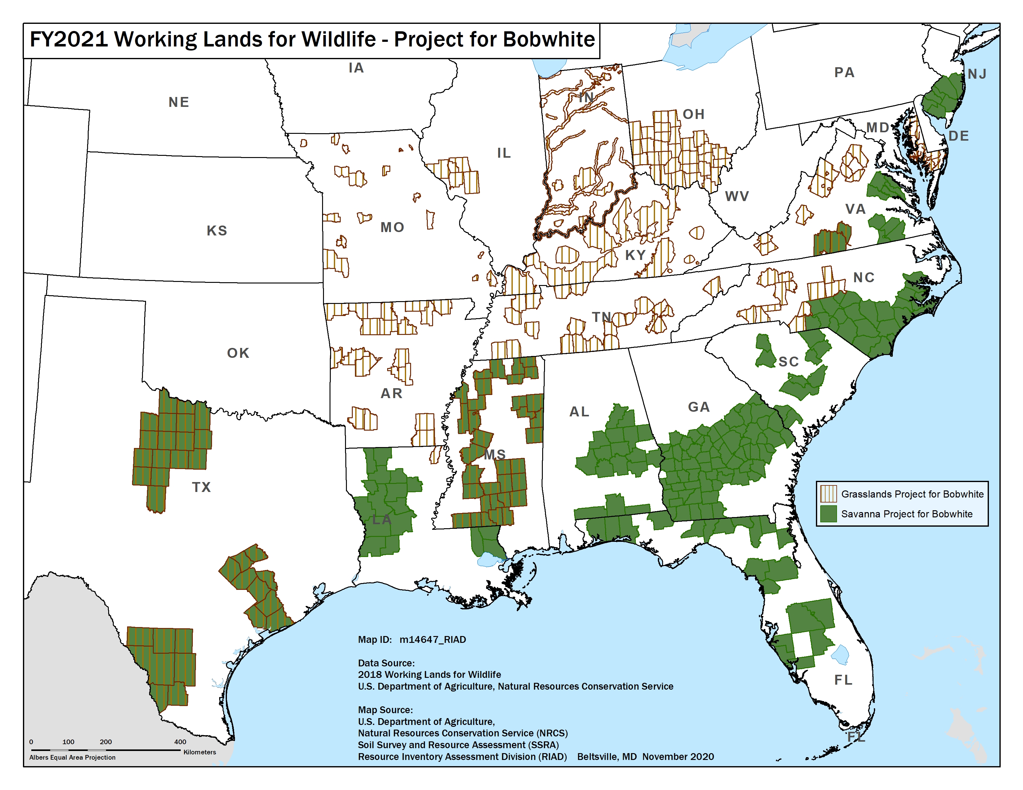
FY17-21 WLFW-Northern bobwhite Map
This map was current as of FY21 for NRCS WLFW-Northern bobwhite but updated for FY22 based on the NRCS state offices that opted into the Northern bobwhite, Grasslands and Savannas Framework partnership (by FY22 there will be 24 states).
Publication Date: 2020
DOWNLOAD FILE — JPEG image, 2,412 kB (2,470,340 bytes)


