


Remote Sens. 2024, 16(9), 1535; https://doi.org/10.3390/rs16091535 (registering DOI) - 26 Apr 2024
Abstract
Research on wildlife monitoring methods is a crucial tool for the conservation of rare wildlife in China. However, the fact that rare wildlife monitoring images in field scenes are easily affected by complex scene information, poorly illuminated, obscured, and blurred limits their use.
[...] Read more.
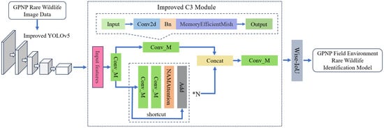
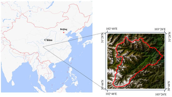
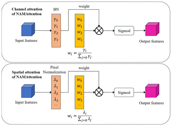
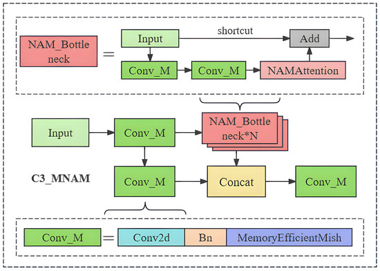
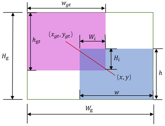
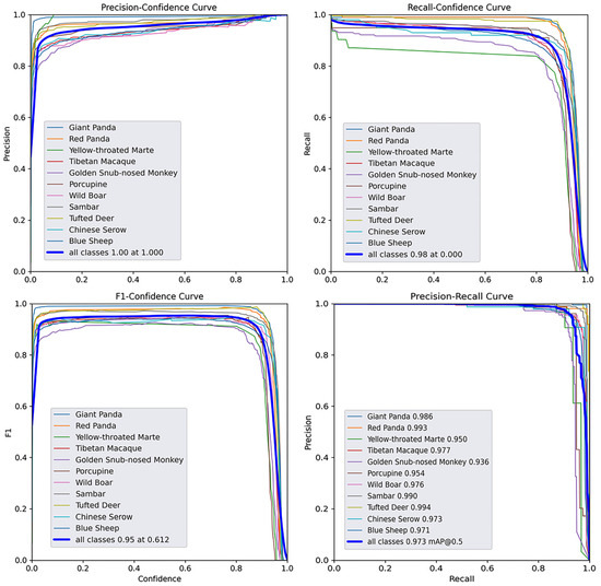
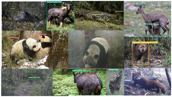
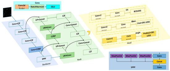
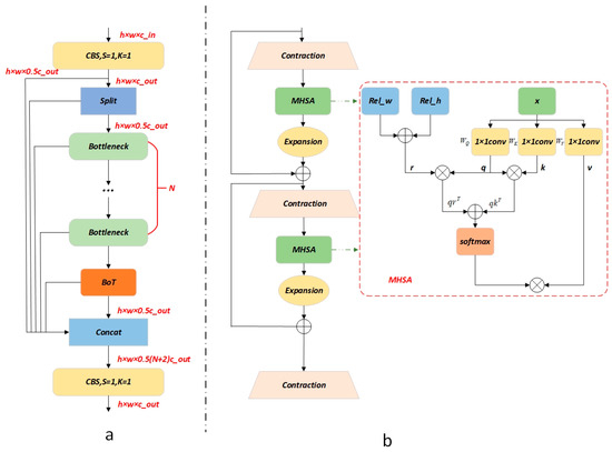
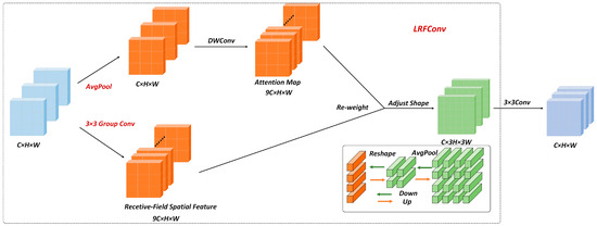
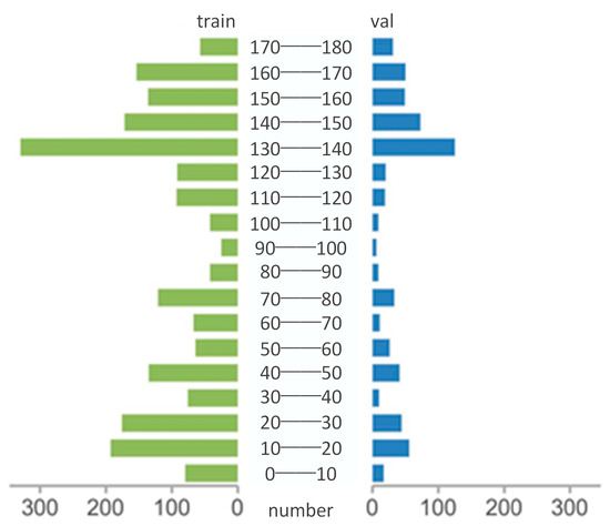
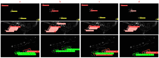
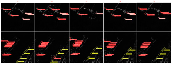
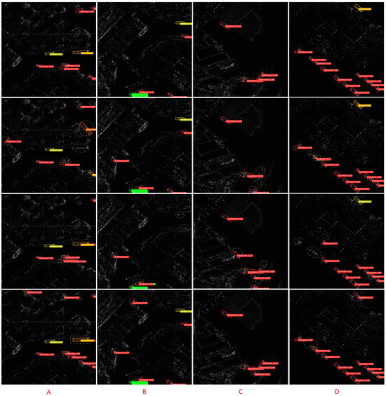
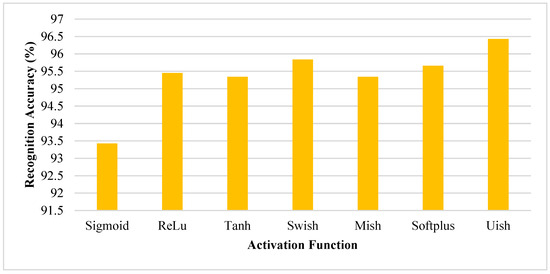
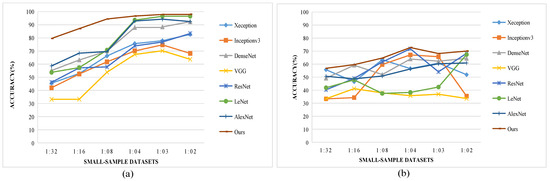
Research on wildlife monitoring methods is a crucial tool for the conservation of rare wildlife in China. However, the fact that rare wildlife monitoring images in field scenes are easily affected by complex scene information, poorly illuminated, obscured, and blurred limits their use. This often results in unstable recognition and low accuracy levels. To address this issue, this paper proposes a novel wildlife identification model for rare animals in Giant Panda National Park (GPNP). We redesigned the C3 module of YOLOv5 using NAMAttention and the MemoryEfficientMish activation function to decrease the weight of field scene features. Additionally, we integrated the WIoU boundary loss function to mitigate the influence of low-quality images during training, resulting in the development of the NMW-YOLOv5 model. Our model achieved 97.3% for mAP50 and 83.3% for mAP50:95 in the LoTE-Animal dataset. When comparing the model with some classical YOLO models for the purpose of conducting comparison experiments, it surpasses the current best-performing model by 1.6% for mAP50:95, showcasing a high level of recognition accuracy. In the generalization ability test, the model has a low error rate for most rare wildlife species and is generally able to identify wildlife in the wild environment of the GPNP with greater accuracy. It has been demonstrated that NMW-YOLOv5 significantly enhances wildlife recognition accuracy in field environments by eliminating irrelevant features and extracting deep, effective features. Furthermore, it exhibits strong detection and recognition capabilities for rare wildlife in GPNP field environments. This could offer a new and effective tool for rare wildlife monitoring in GPNP.
Full article
(This article belongs to the Special Issue Recent Advances in Remote Sensing Image Processing Technology)
►
Show Figures
Graphical abstract


