


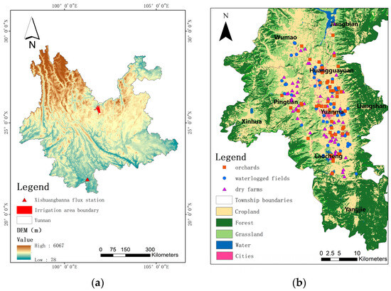
Atmosphere 2024, 15(4), 498; https://doi.org/10.3390/atmos15040498 - 18 Apr 2024
Abstract
A new analytical formula for H0, one of the three parameters (H0, g, and r) on which the NeQuick model is based to describe the altitude profile of the electron density above the F2-layer peak height
[...] Read more.
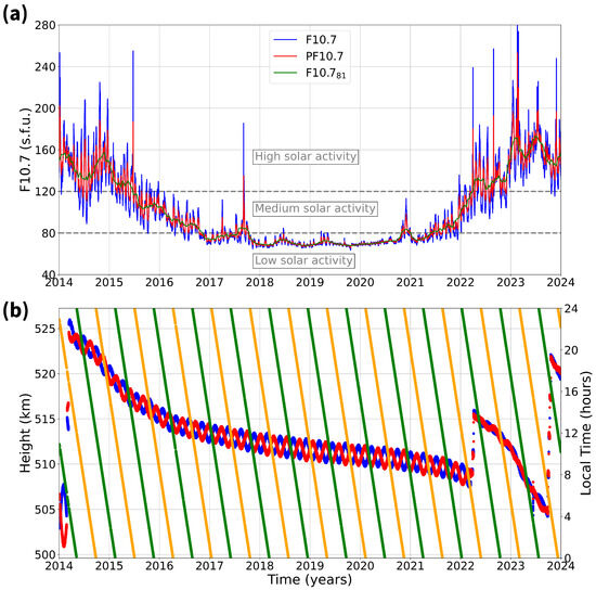
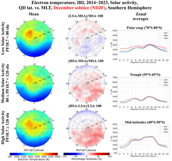
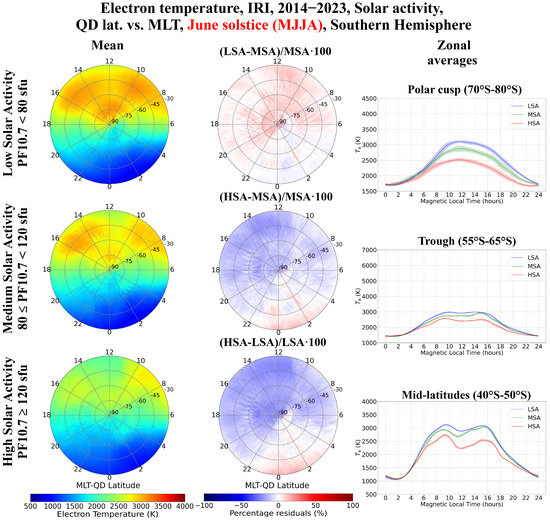
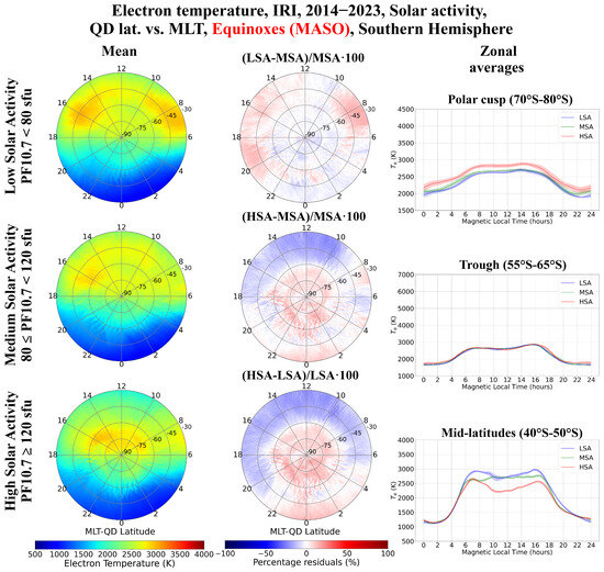
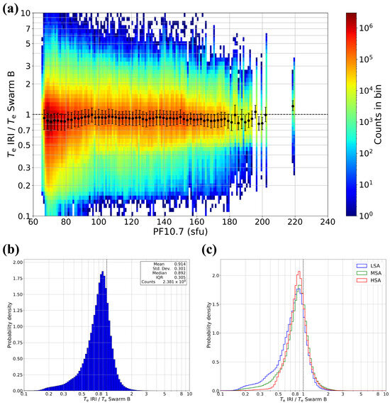
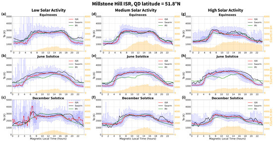
A new analytical formula for H0, one of the three parameters (H0, g, and r) on which the NeQuick model is based to describe the altitude profile of the electron density above the F2-layer peak height hmF2, has recently been proposed. This new analytical representation of H0, called H0,corr, relies on numerical grids based on two different types of datasets. On one side, electron density observations by the Swarm satellites over Europe from December 2013 to September 2018, and on the other side, IRI UP (International Reference Ionosphere UPdate) maps over Europe of the critical frequency of the ordinary mode of propagation associated with the F2 layer, foF2, and hmF2, at 15 min cadence for the same period. The new NeQuick topside representation based on H0,corr, hereafter referred to as NeQuick-corr, improved the original NeQuick topside representation. This work updates the numerical grids of H0,corr by extending the underlying Swarm and IRI UP datasets until December 2021, thus allowing coverage of low solar activity levels, as well. Moreover, concerning Swarm, besides the original dataset, the calibrated one is considered, and corresponding grids of H0,corr calculated. At the same time, the role of g is investigated, by considering values different from the reference one, equal to 0.125, currently adopted. To understand what are the best H0,corr grids to be considered for the NeQuick-corr topside representation, vertical total electron content data for low, middle, and high latitudes, recorded from five low-Earth-orbit satellite missions (COSMIC/FORMOSAT-3, GRACE, METOP, TerraSAR-X, and Swarm) have been analyzed. The updated H0,corr grids based on the original Swarm dataset with a value for g = 0.15, and the updated H0,corr grids based on the calibrated Swarm dataset with a value for g = 0.14, are those for which the best results are obtained. The results show that the performance of the different NeQuick-corr models is reliable also for low latitudes, even though these are outside the spatial domain for which the H0,corr grids were obtained, and are dependent on solar activity.
Full article
(This article belongs to the Special Issue The Role of Solar Wind-Magnetosphere Coupling in the Ionospheric Dynamics)


